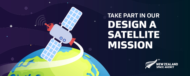
Design a satellite mission essay competition
The NZ Space Agency ‘Design a Satellite Mission’ competition challenged students in years 7 to 10 to think of ways a satellite could help fight climate change. Find out more and read the winning entries.
On this page
Did you know New Zealand is taking part in its first space mission?
Our first ever space mission is a satellite called MethaneSAT that collects information (data) about methane gas. The data will help us work with the rest of the world to reduce methane emissions and fight climate change.
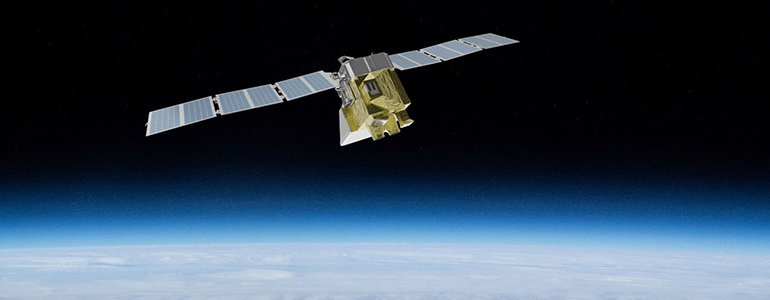
MethaneSAT in orbit
What is methane and why is it so bad?
Methane is a greenhouse gas which means it contributes to climate change by warming the atmosphere. It comes from human activities such as farming and oil and gas extraction. Activities like:
- Farming animals
- Leaks from natural gas systems
- Landfills and waste from homes and businesses
MethaneSAT is helping to fight climate change
Cutting methane emissions is the fastest, most effective way to slow the rate of global warming (climate change).
Find out more about MethaneSAT:
MethaneSAT - turning data into action(external link) — Science Learning Hub
Find out more about MethaneSAT's mission to track emissions back to their origins:
Measuring methane from space(external link) — Science Learning Hub
The competition
Could you design your own satellite mission to help fight climate change?
Satellites orbit the Earth and are part of our everyday lives. The information they beam down to us helps farmers irrigate their fields and plant their crops; lets us surf the Internet, tells us about effects of climate change on the weather, allows us to pay for things, tells us how to get somewhere and keeps us safe when we’re flying.
Students in years 7 to 10 were challenged to write an essay about their own space mission (up to 500 words) and how this satellite could help fight climate change. Creativity was encouraged. Maybe their satellite could track wild-fires, floods or droughts; maybe it could track animals affected by climate change, like polar bears or the Little Blue Penguin; or grow vegetables in space; or look for water on other planets!
Help getting started
Before students started writing, they were encouraged to consider some of the questions below. The answers and links to resources and videos provide real-life examples of satellite missions.
Q. What are some impacts of climate changes in Aotearoa?
Our native species struggle with warmer temperatures but not their predators, this includes plants and animals. There is more energy within our climate systems leading to increased flooding and droughts. Our Kiwi ways of life, including mātauranga and tikanga Māori are also impacted.
Climate connections – why climate change matters(external link) — Science Learning Hub
Climate changes - a warming world(external link) — Science Learning Hub
Why climate change matters to Māori(external link) — Science Learning Hub
Q. What’s actually in a satellite? How do they operate?
The job a satellite is built to do is called its mission. All satellites have common components, but the mission determines the payload (types of sensors) it uses.
Building satellites for Earth observation(external link) — Science Learning Hub
This interactive simulation explores mission requirements and satellite builds.
Build a satellite(external link) — Science Learning Hub
Q. How can satellites measure the effects of climate change?
Climate change affects habitat, which in turn affects species populations. Satellites can track species like penguins and albatross. They can even keep an eye on very tiny species like cyanobacteria, which can cause harmful algal blooms.
Satellites also measure changes in the amount of ice in places like Antarctica and the Southern Alps.
Counting penguins from space(external link) — Science Learning Hub
How are satellites helping albatross?(external link) — Science Learning Hub
Remote sensing and water quality(external link) — Science Learning Hub
Satellites measure sea ice thickness(external link) — Science Learning Hub
Disappearing glaciers(external link) — Science Learning Hub
Q. Greenhouse gases are invisible, so how do satellites track them?
Satellites have sensors, which use infrared light that can ‘tune’ into the frequency of particular greenhouse gas molecules, kind of like how we tune a radio to find a station.
Measuring methane(external link) — Science Learning Hub
Q. What happens with the greenhouse data that satellites collect?
Direct action: MethaneSAT can spot ‘fugitive’ leaks from oil and gas operations. Fixing these leaks can potentially cut global emissions 45%.
MethaneSAT – turning data into action(external link) — Science Learning Hub
Indirect action: satellite data provides the evidence needed to inform policies at local, national and global levels.
Winners and runners-up
First place winners from each age category were awarded a Lego set of the International Space Station, complete with robotic arm to launch satellites into orbit.
Second place winners from each age category won a Virtual-Reality-enhanced mini-Earth model. Judges also awarded prizes for two Outstanding Essays. The authors of these essays will also receive a VR-enhanced mini-Earth model.
Congratulations to our prize-winners and thank you to all students who entered – it was very tough to judge!
Winners:
- Year 7 to 8 – Chloe Drinkwater of Selwyn House School in Christchurch
- Year 9 to 10 – Alys Turley, Emily Buick-Constable, Saffanah Rahman and Zainab Farooq of Wellington Girls’ College in Wellington
Runners-up:
- Year 7 to 8 – Ruqayyah Zaheer, Nusaiba Shahim, Zainab Syeda and Zainab Muhammad of Al-Madinah School in Auckland
- Year 9 to 10 to Hannah McDowall of Dunstan High School in Alexandra
Outstanding essays:
- Diksha Mahajan, Year 8 of Nelson Intermediate in Nelson
- Abiha Asad, Year 8 of Zayed College for Girls in Auckland
Read all the 2022 prize-winning essays below.
Chloe’s essay – winner year 7 to 8
Heat loss satellite
How much heat do you lose in your house every week? Probably more than you would expect. Every household is responsible for adding to global warming because of heat loss.
In fact, a lot of us live our day-to-day lives without even knowing how much of our household heat is being lost. Imagine a satellite which measures heat loss in buildings around New Zealand, and then organises the information and data into regions. This material will be presented at the same time as the weather forecast. New Zealanders will be told the weather forecast for where they live and how much heat per capita has been lost in their region. This satellite could be life-changing.
This satellite will be a geostationary satellite. A satellite which orbits the earth at an altitude of approximately 35 500 Kilometres above the equator. One orbit at this altitude takes the satellite 24 hours, the same amount of time it takes for the earth to rotate. This kind of satellite moves in the same direction as the earth rotates (east to west). Overall the satellite will stay fixed over one spot of the globe. In this case, collecting information from New Zealand.
The satellite will use geothermal cameras to locate how much heat loss is occurring in different places across New Zealand. This satellite will collect its data in a very similar way to how a weather satellite collects its data. It will calculate the total heat loss produced per capita and split it up into regions of New Zealand.
The data collected will be presented alongside the weather forecast, on the TV, radio, etc. This is because the weather forecast is very commonly watched, therefore more people will be aware of the problem occurring due to heat loss from buildings. Once people are aware of this problem it will lead them to be more careful and take precautions to prevent heat loss. This news being shared daily will encourage people to do things such as insulating their homes, and the fact that it will be shared according to the region will encourage a team solution to the problem. The government could provide incentives for regions to be more efficient in reducing heat loss from buildings.
Working together as regions, will not only help to increase people’s understanding of the effect of poorly insulated buildings, but it will also help to decrease New Zealand’s contribution to the problem of global warming. This satellite will educate, will bring about changes in building design and construction and will get communities working together to make a difference
Alys, Emily, Saffanah and Zainab’s essay – winner year 9 to 10
The Greenhouse effect is the increase of gases like CO2, methane and nitrous oxide which create an artificial bubble surrounding our atmosphere. The sun’s energy infiltrates the atmosphere but can’t leave, just like a greenhouse, which severely heats up the planet. The Earth’s climate is perfectly balanced to support all the inhabiting living organisms. An increase of greenhouse gas on Earth will cause this unique balance to be thrown off. Humans release 30 billion tons of greenhouse gases into the atmosphere every year, yet we have no idea which specific actions cause this the most, and who are the main contributors. The toxic atmosphere we’re creating will destroy this planet and we need to stop it, soon.
Our satellite is going to use geothermal imaging to monitor which areas have the highest concentrations of greenhouse gases. This data would then be used to determine which human activities release the most carbon into the atmosphere. This data will be essential in the fight against climate change. We would know exactly what actions we should take in order to preserve Earth. There would no longer be arguments, crazy conspiracy theories and incoherent-potentially useless- policies. There would be clear, crisp-cut data that would tell us exactly which of our actions harm our planet the most and what measures we should take to protect it. In this age of misinformation and confusion, this data would be truly priceless.
The way the satellite will collect information will be by using an optical gas imaging system. This system helps collect data on greenhouse gas production without having to shut down any facilities. The camera utilises high sensitivity infrared imaging technology and uses a specialised spectral filter method to detect all hydrocarbons. It is mainly used in workplaces as a safe way of detecting gas leaks but, with the right design modifications it could be used to see gas emissions from outer space. The satellite will hold a camera which will collect images of greenhouse gas emissions all over New Zealand. Because of machine operated data collection systems the satellite will be completely independent and will only need human input in the form of check overs to make sure the systems are running smoothly.
The data will be collected from the Optical Gas Imaging system, which measures the amount of infrared given off from greenhouse gases. The system is a spectral filter and detector. The data will be sent to a computer (on earth) then scanned and refined through a computer algorithm, so that it is easy to process and find out key information when needed. (Information like which gases are more commonly released). In order for those on earth to use the data, to investigate further and eventually stop the release of the gases; alerts and updates notifying us, where, when and who are contributing to the pollution, will be very beneficial towards improving our methods, when it comes to the production of poisonous gases and the fight against climate change.
Ruqayyah, Nusaiba, Zainab and Zainab’s essay – runner-up year 7 to 8
Endangered Pacific Blue whales
Methane is currently a major concern. Methane is a greenhouse gas that contributes to global warming. It’s accomplished through farming, oil and gas extraction. The Earth's system is made up of four parts. The hydrosphere, geosphere, atmosphere, and biosphere are all interconnected.
Considering the fact water covers 70% of the earth, the hydrosphere is currently a major source of concern. The hydrosphere is the total amount of water on the planet. It includes the amount of water on the surface, underground, and in the earth's atmosphere.
Since there is a lot more energy now, all of the low temperature components are becoming warmer. The warmest month for water temperature is February, with an average of 70.2°F / 21.2°C, August is the coldest month, with the temperature of 58.3°F / 14.6°C. Cetaceans can survive in water temperatures from 10°C to 25°C. They are endothermic homeotherms, with temperatures between 36°C and 37°C.
Our climate can change rapidly in two ways: the sun becomes brighter or dimmer, or greenhouse gasses in the atmosphere increase or decrease. In New Zealand the oceans and seas might rise up to a meter by the end of the century. Indeed, glasshouse gasses trap the sun's heat, resulting in climate change and global warming. Recently, the oceans and seas have absorbed nearly 90% of the heat produced by rising emissions. New Zealand's oceans have become more acidic, warmer, and expansive. As a result, our sea levels are rising.
To New Zealanders, this is a major issue because we live on a large island surrounded by water, which means we are particularly vulnerable to methane and its role in climate change. Rising sea levels have a direct impact on communities and infrastructure due to increased flooding and erosion risks. Climate change is threatening blue whales, which means they have become vulnerable in New Zealand.
Blue whales prefer cold water, so New Zealand's pacific coast water is no longer suitable for them as the temperature increases. Only 10,000 to 25,000 blue whales remain in the world today. Though it may appear to be a large number, unfortunately, it is extremely low and surprisingly only 10% of what it was before. Particularly for New Zealand, given that the most recent research revealed that sadly, there are approximately 718 blue whales in the country.
So, what will our satellite do now? How will it benefit blue whales?
To answer that question, it will monitor sea levels as well as ocean temperature. The blue whales will be chipped, and our satellite will track the number of blue whales and their movements around and in New Zealand. This will help to determine where they are going and where they are located, as well as if they are stuck or trapped.
To summarize, New Zealand's water temperatures are rising rapidly, and as a result, our blue whales are becoming endangered; therefore, the solution is to develop a satellite that tracks their movement as well as water temperatures.
Hannah’s essay – runner-up year 9 to 10
My satellite would be used to help New Zealand’s different species during climate change. One of the biggest threats posed to our native species is deforestation, because they lost their natural habitat. My satellite could take images of New Zealand’s forests and compare after a period of time and see where the most deforestation happens, and why. Monthly image captures might be able to give conservationists the information they need to find out where the most deforestation happens, why and how they can counter the effects. Incredible technology such as remote sensing can help tell where burning and logging happen in real time, so conservationists like DOC can try to intervene as it happens, especially in protected areas.
Native species to New Zealand face loss of habitat as deforestation happens, and since 2000 there has been a 12% loss of natural forests. Lots of New Zealand’s native forests have been cleared for farming and settlement, burned down due to wildfire, and been used for timber logging. For animals such as kiwi, their native forest habitat has been dramatically reduced to make way for human habitation and farmland. I think forestry monitoring using data gained via satellite is very important because it can promote sustainable land and farm management.
This satellite would have GPS maps to effectively collect information about forestry areas, VHR satellite imagery to provide images of the damaged forests and remote sensing to tell when and where damage happens.
From 1990 to 2019, our forestry removed between 21.1 million to 36.8 million tonnes of carbon dioxide from the atmosphere, however as our woodland areas decrease so will the amount of harmful gases that will have been removed. Forested areas slow water flow, allowing it to soak into the ground and when deforestation happens, the water runs off the soil and increasing rates of water flow can cause floods and erosion especially in mountain regions. Tree roots underground stabilise the soil so when forests are cleared soil and nutrients are washed off the land and into waterways. This is not a good thing because it pollutes waterways.
This satellite would be a good thing because it would help save our native forests, which would help stop as many harmful gases going into our atmosphere, help stop floods and mountain erosion and stop as much habitat loss for New Zealand’s animals and native birds.
Diksha’s essay – Outstanding essay
Ways satellites can help in Climate Change
A satellite is a moon, planet or machine that revolves around a planet or a star. Climate change refers to long-term shifts in temperature and weather patterns on earth. Climate change is caused due to the burning of fossil fuels which results in a rise of methane and carbon dioxide. This increases temperature and causes water evaporation on land and water, increasing water vapour in the earth’s atmosphere.
My satellite mission would be called “The Vapour Detecting Mission” (VDT). This satellite will detect the amount of water vapour in the Earth’s atmosphere and water on other planets. Water vapour is an important indicator of climate change. The main body of my satellite would be made of an aluminium composite material made with fibre reinforced by a plastic and glass matrix. All of these materials would be sourced from upcycled materials already on Earth. Using these materials would double down on the mission to develop innovations and research possibilities by reducing climate change because its design would be developed with sustainable principles.
The total mass of the VDT will be 1,840 kg, and this would require 852 kg of fuel; however, it would have solar panels and these panels would be arranged to capture maximum sun. This is how my satellite would use less fuel than the other satellites. My satellite would have a fitted hygrometer, a device used to record the amount of water vapour in the air, and a camera facing the hygrometer to record the reading, it would also have batteries which will be charged by the solar panels. When the VDT is in the earth's atmosphere, the fuel can be switched off, sometimes to save the fuel and the gravitational force would hold the satellite and allow it to orbit. If the VDT goes to another planet it would start in Earth’s orbit and if the fuel is turned on the VDT could reach full velocity and travel into the gravitational pull of a distant planet. When the satellite is in space, solar energy could be the potential source of energy and when the satellite is a few lightyears away from the planet, fuel will start will be the source of potential energy which would allow the satellite to travel extreme distances.
Detecting water vapour would not only help measure climate change on earth but also determine if other planets have water or not. If the hygrometer shows some signs of water vapour then the space agency can conclude whether the planet has water or not.
At last, I can conclude that my satellite would help monitor climate change and would be made from recycled materials. My satellite would help find the amount of water vapour in the atmosphere and also help find water on other planets. The satellite would use less fuel than other satellites and will have a unique way of operation.
Abiha’s essay – Outstanding essay
It is no secret that climate change is slowly taking over our planet little by little, and getting answers to deal with climate change may be intimidating. But there is a solution.
Far up in deep space, our scientists came up with an idea of sending a machine called a satellite. A satellite is no ordinary thing. A satellite detects the earth by flowing around in space. It has a huge antenna, which is connected to another bass antenna down on earth. A satellite also has solar panels, so it gets its energy from the sun.
Some Parts of a satellite are:
1. Propellant Tank: a propellant tank is a tank that stores the propellant inside. Propellant is a chemical substance which is used to power the vehicle.
2. Solar array: a solar array is a group of many tiny solar panels that work together to generate electricity.
3. High gain antenna: a high gain antenna is a large dish used for sending and receiving data from and to the earth bass antenna.
Not only does the satellite work up there in the unknown, but it also detects our little Earth, gathering information about so many things. For example, the weather forecast, studying the weather conditions and giving us the best results of the weather. It also gives us statistics on the oceans, forests, mountains, and desserts, letting us know the current state in each of the biomes of the world. All of this is what we call satellite data, and these are only a few examples, of which there are many more to talk about. All this is enough to persuade us into thinking that the satellite can help us a lot.
Yet can it help us resolve the problem of climate change? Climate change is a big topic. Our planet has been experiencing a lot of changes throughout the past few centuries. Climate change is a bit like weather, but weather only lasts for minutes or hours, while climate lasts for a long time. Climate change is impacting human health. Rising temperatures are increasingly killing humans, animals, and trees day by day. New diseases are spreading as the ice melts and releases trapped microbes, viruses etc. Ice glaciers are melting, heat waves being timidly hot, weather patterns are changing, global warming is increasing, and sea levels are rising.
Satellite takes pictures of areas of our planet, informing us where we have less vegetation or green areas, so it tracks changes of vegetation. This helps us to make better ecosystem regulations by planting more in endangered areas. Through this we can achieve dual benefits. On one side we can increase the greenery on our planet, which can have a beneficial impact on our physical and mental health. However, on the other hand, it also has a profound negative impact on our climate change and environmental degradation, by reducing air pollution in the atmosphere. So, in this way we can achieve advantageous effects of Satellite data.
“Green is the prime color of the world, and that is where loveliness arises,” Pedro Calderon La Barca.
Competition rules
This competition was open to all students in New Zealand in Years 7 to 10. Students could work alone or in teams of up to four. All submissions had to be original work. Each student could submit only one entry. Previous winners of the New Zealand NASA Scientist for a Day could submit an entry but were not eligible to receive a prize. The maximum essay length was 500 words. Essays could be written in English or Te Reo Māori.
The deadline for entries was 5pm, Friday 28 October 2022.
By participating, students agreed to their essay being published, as excerpts or in its entirety, on the Ministry of Business, Innovation and Employment website, along with the author’s name, year group and school.
Entries had to be submitted by teachers, parents, or guardians, not by the students themselves. All entries meeting the prescribed requirements were submitted for judging. The decision of the judges is final.
Any questions?
Contact us here at the Space Agency: nzspaceagency@mbie.govt.nz